


Informatics Educational Institutions & Programs

Size of this PNG preview of this SVG file: 798 × 599 pixels. Other resolutions: 320 × 240 pixels | 639 × 480 pixels | 1,022 × 768 pixels | 1,280 × 962 pixels | 2,560 × 1,923 pixels | 2,034 × 1,528 pixels.
Original file (SVG file, nominally 2,034 × 1,528 pixels, file size: 1.03 MB)
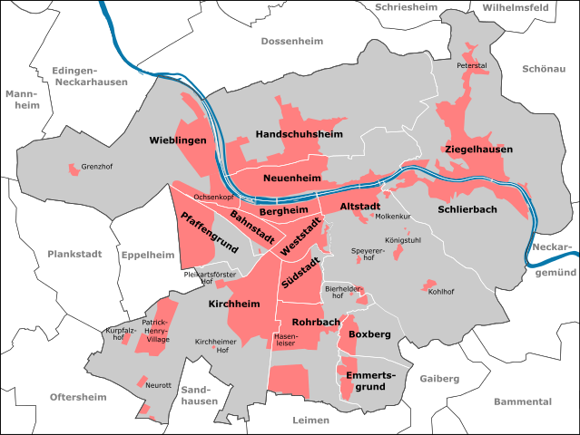
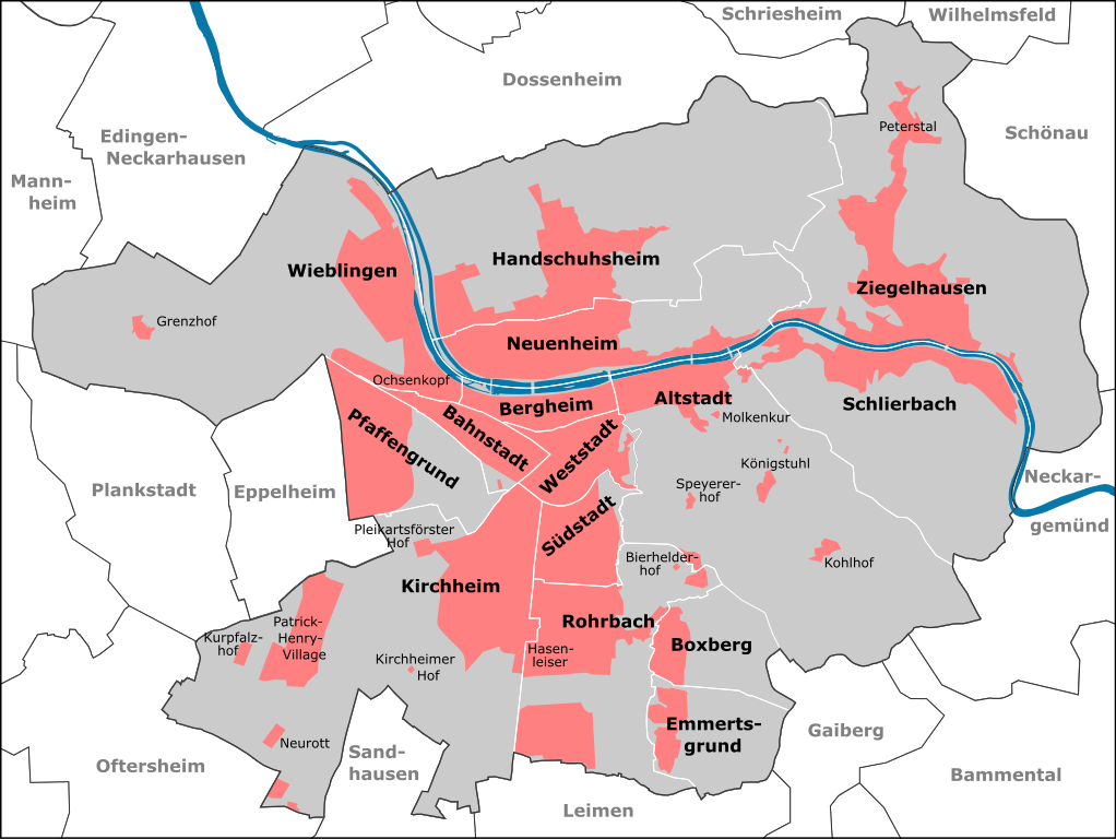
| Description | Stadtteile Heidelbergs ab 2012 | ||||||||||||||||||||||||||||
| Date | |||||||||||||||||||||||||||||
| Source |
|
||||||||||||||||||||||||||||
| Author | Pitichinaccio (talk) | ||||||||||||||||||||||||||||
File history
Click on a date/time to view the file as it appeared at that time.
| Date/Time | Thumbnail | Dimensions | User | Comment | |
|---|---|---|---|---|---|
| current | 10:41, 4 January 2013 | | 2,034 × 1,528 (1.03 MB) | Pitichinaccio | erg. Edingen |
| 19:05, 1 January 2013 |  | 2,034 × 1,528 (1.02 MB) | Pitichinaccio | {{Information |Description=Stadtteile Heidelbergs ab 2012 |Source={{OpenStreetMap | name = Heidelberg | location = Heidelberg | description = Map of Heidelberg, Germany | top = 49.4620 | bottom = 49.3510 | left ... |
File usage
The following pages on the English Wikipedia use this file (pages on other projects are not listed):
Global file usage
The following other wikis use this file:
- Usage on ast.wikipedia.org
- Usage on azb.wikipedia.org
- Usage on bg.wikipedia.org
- Usage on bn.wikipedia.org
- Usage on bs.wikipedia.org
- Usage on da.wikipedia.org
- Usage on de.wikipedia.org
- Usage on de.wikivoyage.org
- Usage on el.wikipedia.org
- Usage on eo.wikipedia.org
- Usage on es.wikipedia.org
- Usage on fi.wikipedia.org
- Usage on fr.wikipedia.org
- Usage on he.wikipedia.org
- Usage on hr.wikipedia.org
- Usage on it.wikipedia.org
- Usage on it.wikivoyage.org
- Usage on ja.wikipedia.org
- Usage on mk.wikipedia.org
- Usage on no.wikipedia.org
- Usage on pl.wikipedia.org
- Usage on ro.wikipedia.org
- Usage on sco.wikipedia.org
- Usage on sl.wikipedia.org
- Usage on sr.wikipedia.org
- Usage on vi.wikipedia.org
