


Informatics Educational Institutions & Programs

Original file (SVG file, nominally 1,100 × 721 pixels, file size: 403 KB)
Summary
| Description |
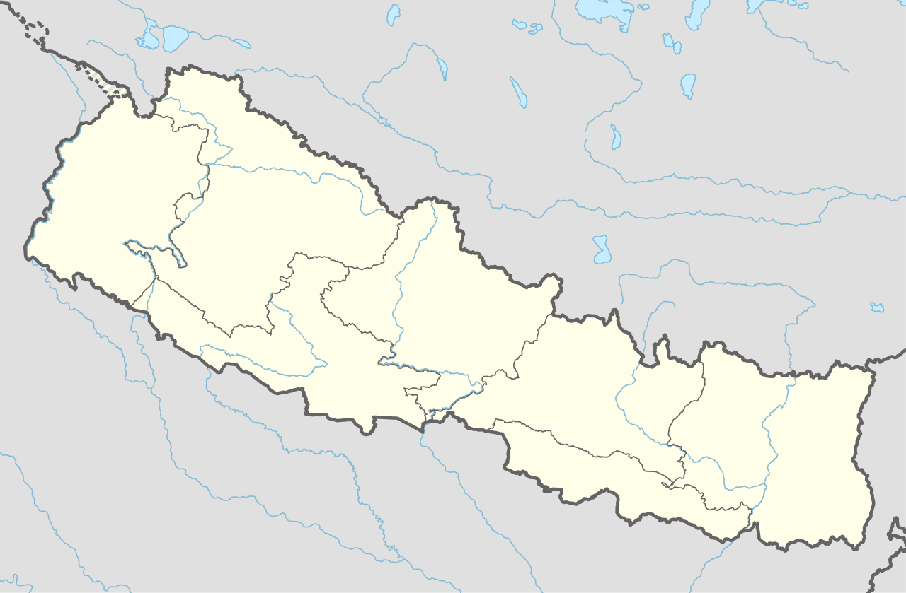
Deutsch: Positionskarte von Nepal
English: Location map of Nepal including the 7 provinces
|
||||||||||||
| Date | |||||||||||||
| Source |
Own work using:
|
||||||||||||
| Author | NordNordWest | ||||||||||||
| Other versions |
|
||||||||||||


|
This map has been made or improved in the German Kartenwerkstatt (Map Lab). You can propose maps to improve as well.
|
Licensing
Usage of this file with:

explanatory notes: Legally binding is only the full legalcode. For a free usage I recommend to respect the following licence conditions:
1. Provide my name as given above: NordNordWest,
2. a copy of, or the URI for, the applicable license: https://creativecommons.org/licenses/by-sa/3.0/de/legalcode,
3. the title of the work,
4. in the case of an adaptation, a credit identifying the use of the work in the adaptation.
This license and the rights granted hereunder will terminate automatically upon any breach by you of the terms of this license. Any of the above conditions can be waived if you get permission from the copyright holder. If you have questions or wish differing conditions, please contact me through nnwest or my discussion page ![]() t-online.de
t-online.de
- You are free:
- to share – to copy, distribute and transmit the work
- to remix – to adapt the work
- Under the following conditions:
- attribution – You must give appropriate credit, provide a link to the license, and indicate if changes were made. You may do so in any reasonable manner, but not in any way that suggests the licensor endorses you or your use.
- share alike – If you remix, transform, or build upon the material, you must distribute your contributions under the same or compatible license as the original.

File history
Click on a date/time to view the file as it appeared at that time.
| Date/Time | Thumbnail | Dimensions | User | Comment | |
|---|---|---|---|---|---|
| current | 17:59, 2 June 2020 | | 1,100 × 721 (403 KB) | NordNordWest | corr |
| 17:13, 22 March 2020 |  | 1,100 × 721 (401 KB) | NordNordWest | corr | |
| 16:50, 20 November 2019 |  | 1,100 × 721 (398 KB) | NordNordWest | corr | |
| 21:07, 2 June 2018 |  | 1,100 × 721 (399 KB) | NordNordWest | == {{int:filedesc}} == {{Information |description= {{de|1=Positionskarte von Nepal}} {{en|1=Location map of Nepal}} {{Location map series N |stretching=114 |top=31.0 |bottom=26.0 |left=79.8 |right=88.5 }} |source={{Own using}} * United States National Imagery and Mapping Agency data |date=2018-06-02 |author={{U|NordNordWest}} |permission= |other_versions= }} {{Kartenwerkstatt}} == {{int:license-header}} == {{User:NordNordWest/LicenceMap}} Category:Location maps of Asia (series N) [[Cate... |
File usage
More than 100 pages use this file. The following list shows the first 100 pages that use this file only. A full list is available.
- 2005 AFC President's Cup
- Amppipal
- Badarmude bus explosion
- Baglung
- Bandipur Rural Municipality
- Banepa
- Bhadrapur Airport
- Bhaktapur
- Bhaktapur Cancer Hospital
- Bharatpur, Nepal
- Bharatpur Airport
- Bhimdatta
- Bhimphedi
- Bhojpur Municipality
- Biratnagar Airport
- Birendranagar
- Birgunj
- Boudhanath
- Butwal
- Chaurjahari Airport
- Chukhung
- Damak Municipality
- Dhading Besi
- Dhangadhi
- Dhankuta
- Dharahara
- Dharan
- Dhime
- Dhorpatan
- Dhulikhel
- Dingboche
- Dolpa Airport
- Dunai, Nepal
- Gaighat, Nepal
- Gaur, Nepal
- Gautam Buddha Airport
- Ghorahi
- Gorakshep
- Gorkha Municipality
- Halesi-Maratika Caves
- Hetauda
- Ilam Municipality
- Inaruwa Municipality
- Itahari
- Janaki Mandir
- Jiri
- Jomsom Airport
- Jumla Airport
- Kali Gandaki Gorge
- Kamalamai
- Kapilvastu Municipality
- Kathmandu
- Khandbari Municipality
- Khumjung
- Kirtipur
- Kohalpur
- Kopan Monastery
- Koshi Tappu Wildlife Reserve
- Lalitpur, Nepal
- Lamidanda Airport
- Lekhnath
- List of cities in Nepal
- List of top-division football clubs in AFC countries
- Liwang, Rolpa
- Lukla
- Manakamana Temple (Sankhuwasabha)
- Meghauli Airport
- Mirjapur, Sarlahi
- Muktinath
- Nagarkot
- National Museum of Nepal
- Nepal
- Nepal national cricket team
- Nepalgunj
- Nepalgunj Airport
- Nuwakot, Bagmati Province
- Okhaldhunga
- Panauti
- Pashupatinath Temple
- Phaplu Airport
- Phungling Municipality
- Pokhara Airport
- Putalibazar
- Pyuthan Municipality
- Rajbiraj
- Rangeli Municipality
- Rolpa Municipality
- Rukumkot
- Rumjatar Airport
- Siddharthanagar
- Simara Airport
- Simikot
- Simikot Airport
- Surkhet Airport
- Tengboche
- Tenzing-Hillary Airport
- Thadiya
- Thalara
- Tribhuvan International Airport
- Tumlingtar Airport
View more links to this file.
Global file usage
The following other wikis use this file:
- Usage on ab.wikipedia.org
- Usage on af.wikipedia.org
- Usage on an.wikipedia.org
- Usage on azb.wikipedia.org
- Usage on az.wikipedia.org
- Usage on ban.wikipedia.org
- Usage on bcl.wikipedia.org
- Usage on be.wikipedia.org
- Usage on bg.wikipedia.org
- Usage on bh.wikipedia.org
View more global usage of this file.
